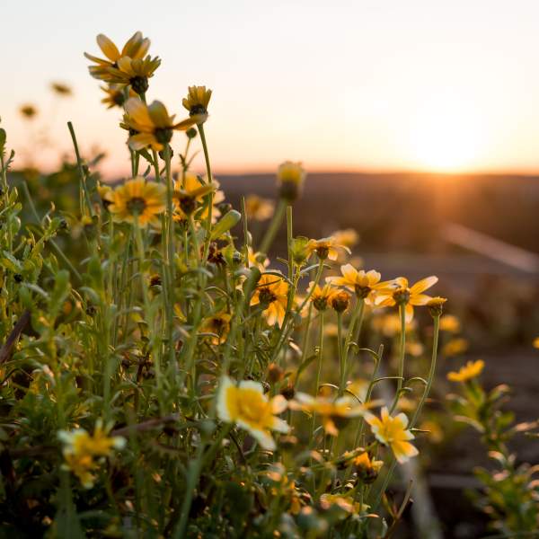
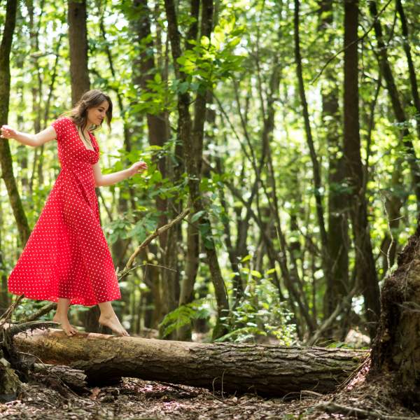
UN TEMPS POUR RETROUVER, DANS LA NATURE,
L'ESSENCE MÊME DU BIEN-ÊTRE
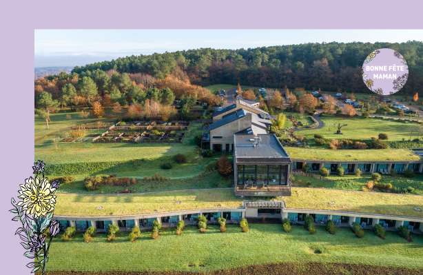
L'Eco-Hotel Spa Yves Rocher, est un Hôtel Spa au standing 4 étoiles, au cœur de la Bretagne… Jour après nuit, La Grée des Landes réussit le pari de concilier bien-être et harmonie avec la Nature. Ici, en haut de la colline, aux portes du village de La Gacilly en Bretagne, nous prenons soin de vous en prenant soin de la Nature. Et la Nature nous le rend bien. Les saisons y sont belles et vraies, la cuisine bio et locavore, l’art dans son élément… Au Spa Yves Rocher, les rituels de soin puisent leur force du végétal. Vivre à La Grée des Landes est une expérience à la fois simple, apaisée et inspirante. Un luxe qui se vit d’abord de l’intérieur.
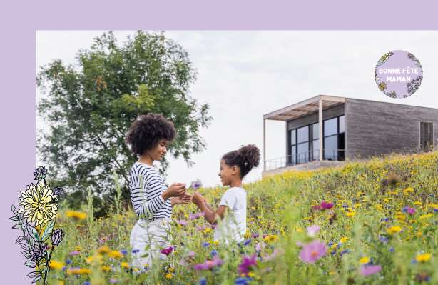
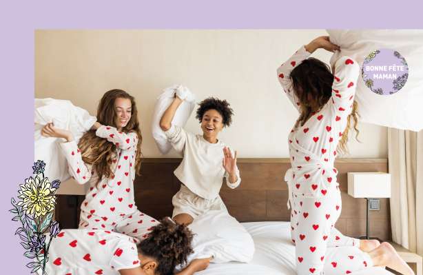
C’EST BIENTÔT LA FÊTE DES MÈRES !
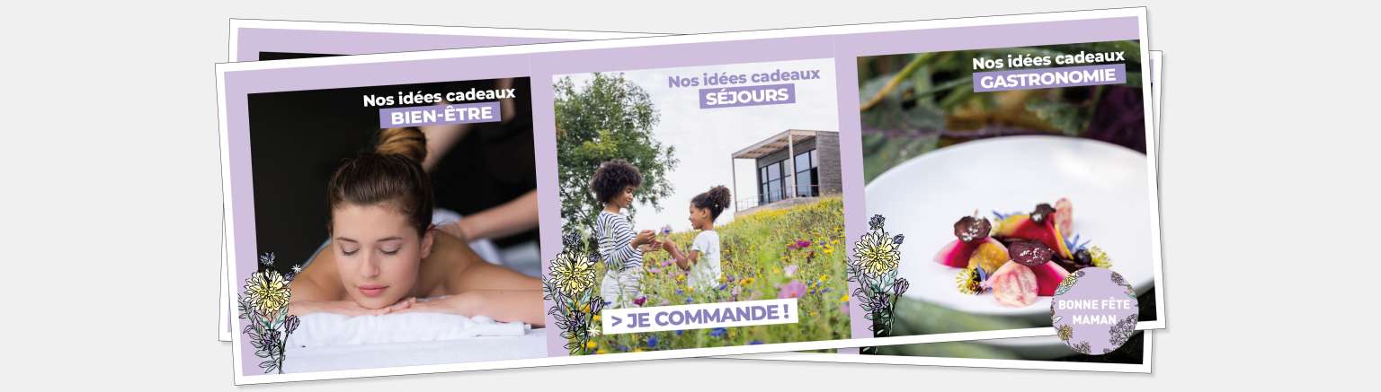
Votre maman est plutôt COFFRETS CADEAUX ou DÉJEUNER GASTRONOMIQUE ?
Choisissez le CADEAU IDÉAL à OFFRIR ou à PARTAGER avec votre maman au sein de La Grée des Landes, Éco-Hôtel Spa Yves Rocher, venant d’être distinguée par une Clef MICHELIN pour ses expériences de Séjour les plus remarquables ! Entre Séjour, Soin, Pause Bien-être, Activités Wellness, Déjeuner ou Dîner Gastronomique… vous aurez le choix pour faire vivre un moment unique à votre Maman ! > Consultez nos Coffrets Cadeaux à partir de 50€ par personne
***
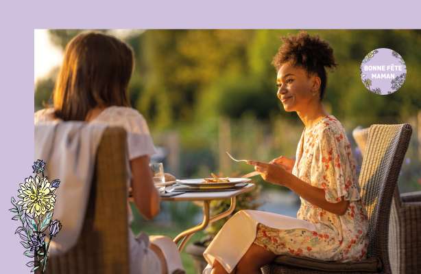
Offrez un DÉJEUNER rempli de complicité et passez un moment gourmand avec votre Maman au Restaurant Gastronomique le DIMANCHE 26 MAI > Menu à partir de 56€ par personne - > Consultez la Carte du Chef > Réservez votre table !
***
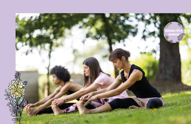
Et pour une parenthèse détente, pensez à nos séances d’aquarelax, aqualsculpt, aquatraining, d’une balade des 5 sens…
Découvrez l'intégralité de notre Programme Wellness. > Votre activité Wellness à partir de 24€ / personne > Réservez dès maintenant votre séance
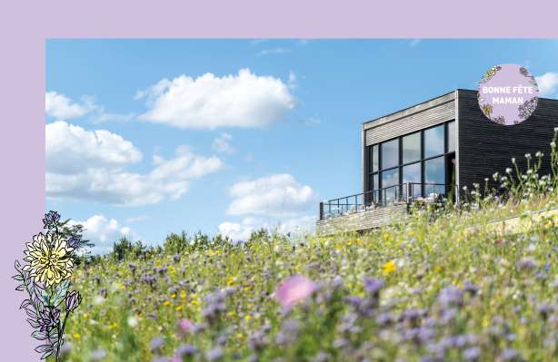
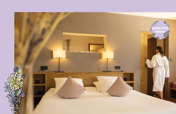
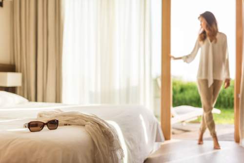
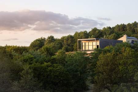
Les chambres
LA NUIT, LE JOUR
Passer une nuit à La Grée des Landes, c'est se reconnecter avec soi-même... et avec la Nature. En intérieur, 29 chambres vous accueillent, toutes de plain-pied et dotées d’une terrasse privative. Pour les yeux, les mille teintes de verts et les lumières douces de la Bretagne. Pour les sens, la chaleur des matières et la caresse d’une couette en coton bio. Pour le cœur, la conscience de vivre un moment d’exception. Et au bout du jardin ? La cabane. Pour une nuit ou pour un soin, elle vous invite à renouer avec votre âme d'enfant. Mieux qu’un hébergement insolite : un tête-à-tête avec les arbres, suspendu à six mètres du sol.
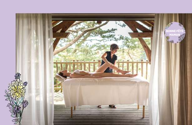
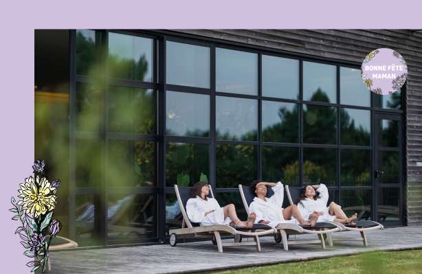
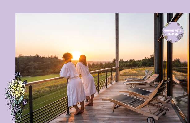
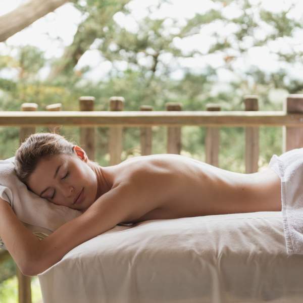
Le spa Yves Rocher
DÉTENTE.
RELAXATION.
SILENCE.
Bienvenue au Spa. Ici, le ciel et l’eau se mêlent, le soleil convoque au repos. Nos rituels de soins, pour le visage ou pour le corps, fruits de l’expertise de la Marque Yves Rocher vous ouvrent les portes d’un bien-être total. Volupté du bassin à débordement, beauté saisissante du paysage qui s’étend à perte de vue : il est temps de s’abandonner.
NATURAL
SLOWLIFE
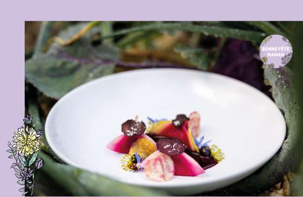
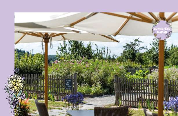
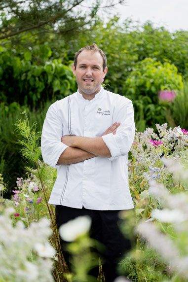
Le Restaurant Bio & Locavore
BON,
BEAU ET SAIN.
Entrez aux Jardins Sauvages, le restaurant gastronomique bio et locavore où la Nature inspire les recettes, au rythme des saisons. Ici, le jardin potager indique les légumes à cuisiner, et toutes les herbes, fleurs et aromates sont les bienvenus. Car notre Chef, Fabien Manzoni, n’est pas seulement talentueux, amoureux du bio et totalement locavore : il parle couramment le végétal.
Le Restaurant gastronomique Bio & Locavore les « Jardins Sauvages », est fier d’être sélectionné par le Guide MICHELIN France de l’Edition 2022 pour l’excellence de sa cuisine et renouvelle une BELLE DISTINCTION, l’Étoile Verte MICHELIN, Gastronomie et durabilité, pour couronner son ENGAGEMENT QUOTIDIEN dans une DÉMARCHE VERTUEUSE pour le territoire. La Grée des Landes, Éco Hôtel Spa Yves Rocher, incarne, une nouvelle fois, la Marque, dans son art de vivre et son engagement environnemental !
AU COEUR DE
LA NATURE
La Grée des Landes a sélectionné pour vous

Ils nous suivent sur :
@lagreedeslandes